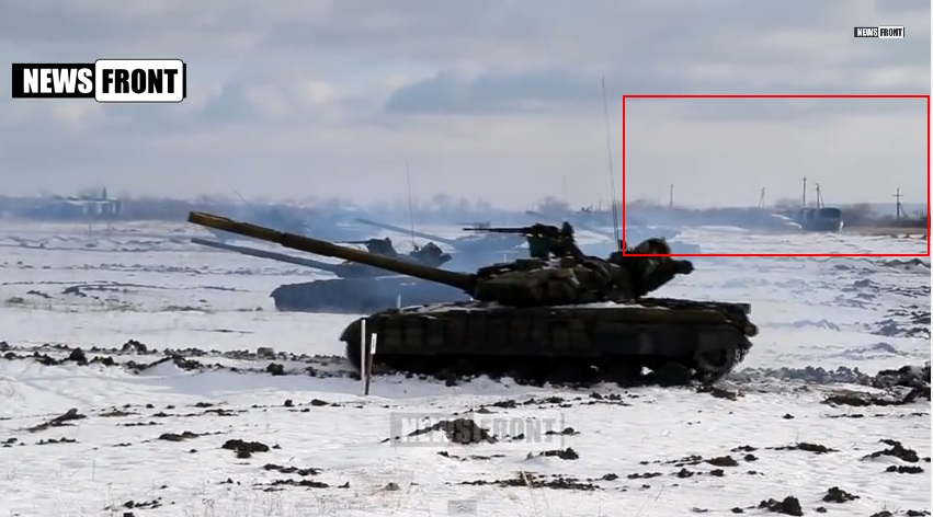
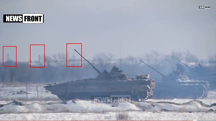
On December 31, 2014, we reported that the Russian-backed separatists in Ukraine appeared to have received a new supply of armor from Russia. This video revealed the presence of the BPM-97, which stands for Boyevaya Pogranichnaya Mashina (“Combat Border Vehicle”) used by the Russian border guards, which are part of the Federal Security Service or FSB. This vehicle is not known to be in service in Ukraine.
The terrain visible in the video appeared at first to be flat and nearly featureless and it seemed it would be difficult to locate this area. But by matching other clues on social media, we were able to geolocate the Russian armor inside Ukraine.
This video is labeled “LNR [‘Lugansk People’s Republic’] Began Large-Scale Exercises Not from from Front Line”.
The man in the cap with the red star speaking is Col. Kiselyev, deputy head of the LNR People’s Militia, or Russian-backed separatists. He speaks with the Russian-language accent native to the Donbass. The red star could indicate he is part of the LNR Communist faction or just admires the Soviet insignia. Thus, the video seems likely to be filmed in Lugansk, but this is not definitive.
Here’s a video of Kiselyev handing out awards to some fighters on December 13 in which he says, “We are local residents of Lugansk” at 0:33 in the accent typical to the region — by contrast with the volunteers from South Ossetia dressed in hats common to the North Caucasus, whom he is addressing.
Here’s a picture of him published earlier in December by the blogger Colonel Cassad from the press office of the Army of the South East which evidently was a screen grab from this video:

Then on January 2, 2015, Lugansk News Today, a local news publication, published a photograph of the BPM-97 obtained from a fighter going by a fragment of the building visible in the scene. It was recognizable to locals as the Volodymyr Dal University
Translation: the photo was made inside the courtyard of the Dal University, dormitory no. 4 is in the background. No Russian forces in Lugansk?
Another local chipped in:
Translation: That’s past the Machinists’ Institute bus stop. In the Vatutina quarter.
A blogger named Antirezhim Yolki (@murderotica_) then geolocated the vehicle position in Lugansk here on Google Maps:
Lugansk Today then confirmed it:
Bellingcat, the investigative site, covered the story and made additional confirmations of the elements of the street scene which is important because there are a lot of brown buildings with white newspaper boxes in front of them in Ukrainian cities.
Google Street View no longer works for Lugansk but it can still be seen on Yandex where we confirmed the whole scene.
Getting the location for one photo was important, but it’s also vital to show the location of the group of BMP-97s on the firing range to make the case that Russia has significantly contributed to the war — and that this armor identified only with Russia’s army, Interior Ministry, Emergencies Ministry and Kazakhstan’s ministries is Ukraine, and not the other locations.
Lugansk News Today, knowing the local terrain, guessed that the video was taken on a known former Ukrainian army base and provided a Google link:
The blogger @5urpher said
he believed a likely spot for the fields in the December 31 video “not
far from the front line” was an old Ukrainian army base, No. 3035, which
had been taken over by the separatists, and which has a firing range
and testing ground on it. It is just north of Aleksandrovsk
(Oleksandrivsk), a town to the west of Lugansk.
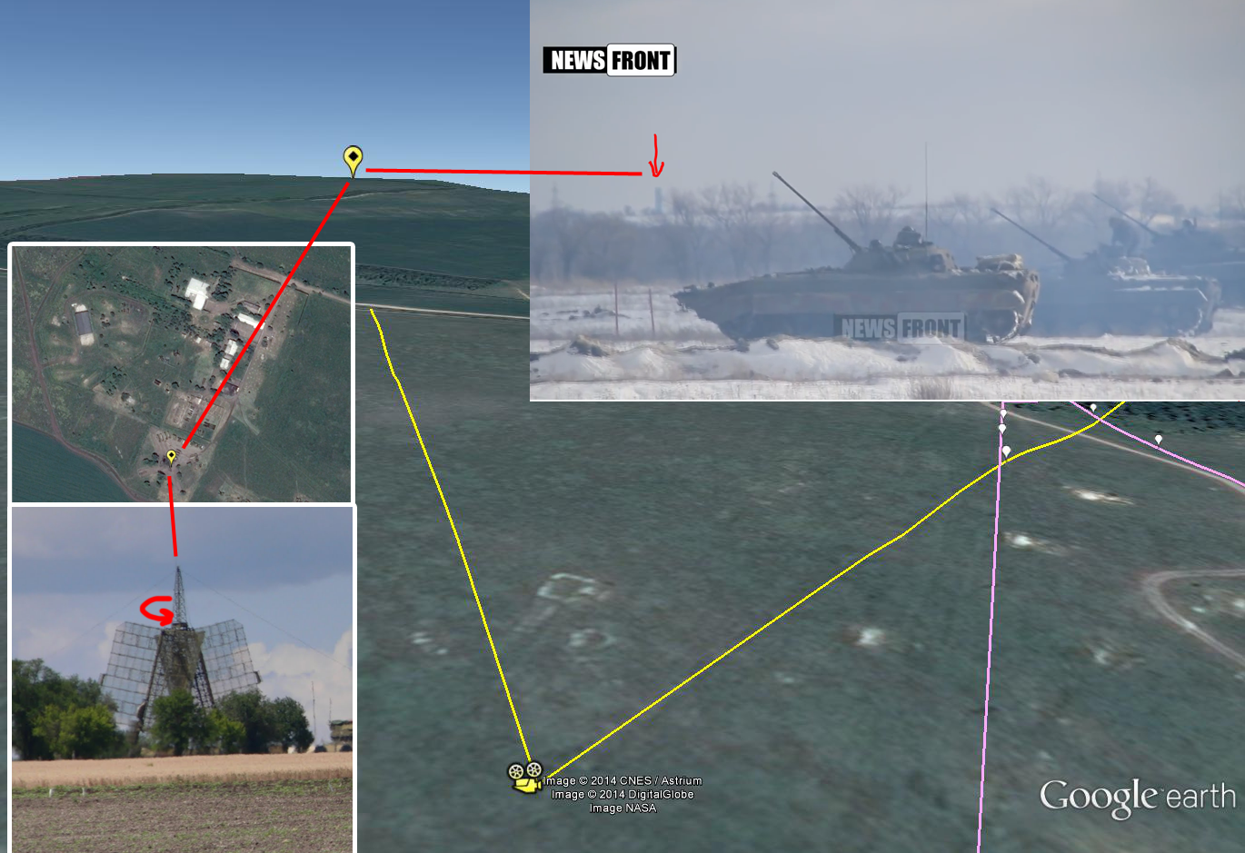
But it still had to be proven that the good guess for the scene, and the knowledge of locals of the area, and even coordinates possibly provided by a local cameraman’s account matched up with Google Maps and other known documentation of the area. So other landmarks had to be confirmed:
The TV tower is to the east of the firing range in Lugansk here on Google Maps.
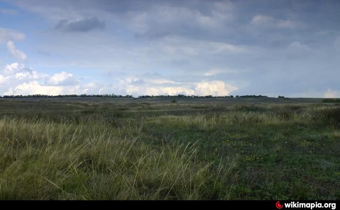
Fortunately, some local photographers had gotten to this same area before and in
recent years have uploaded their photos. A picture of Base 3035 uploaded
to Wikimapia by sandersalex which looks like it would fit the terrain in the video:
Looking in the Base 3035 area, we can find a photo taken by sanja.byelkin
taken from a position further north on this field labeled “View on
Lugansk,” with a view on to a horizon with a tower in it geolocated here:
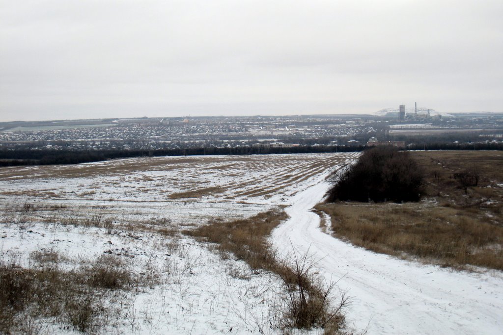
But we have determined that the view is to the south, on to the Yubileynoye mine, as can be seen here in this horizon picture by Bobyor Grigory and in this picture by Sochi2008 labeled “Yubileynoye” and located on Google Maps here.
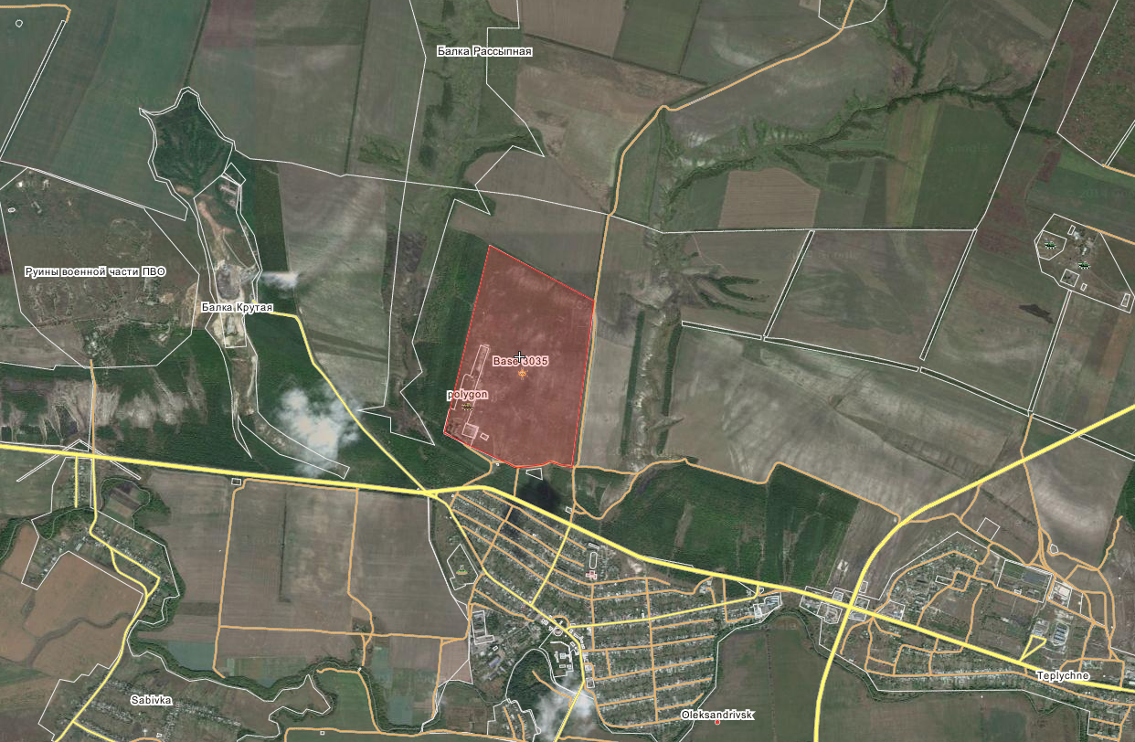
For reference, here’s a screen shot of the whole base from Wikimapia which show “ruins of anti-aircraft base”; Balka Krutaya, the hill; poligon is the Russian word for “testing ground” and Base 3035.
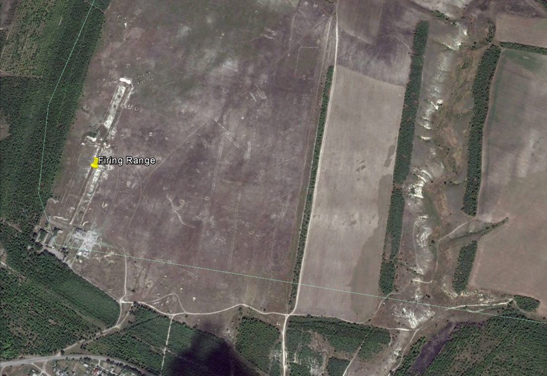
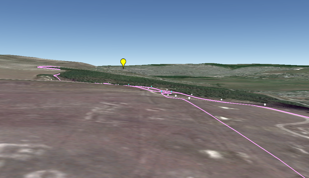
Here’s the same area in Google Earth (48°36’05.12″ N 39°11’05.37″
E), where the elevations can be seen better which are also visible in
the video:
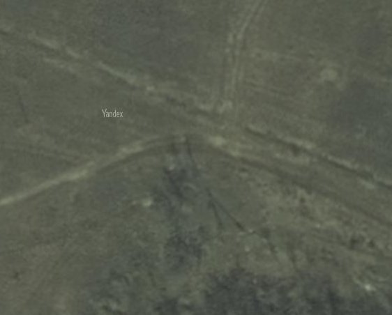
There’s a cluster of utility poles visible around 4:30 in the video:
Here’s a similar cluster of 5 poles on Yandex, some leaning:
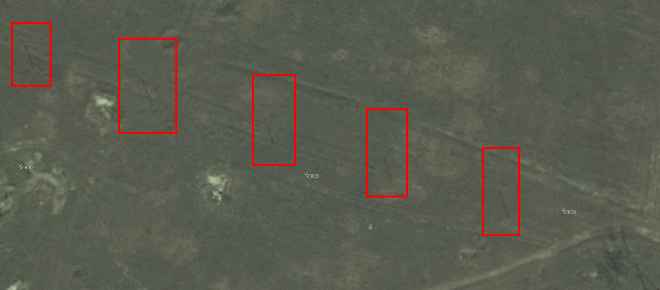
A straight line of 5 utility poles can be seen along the horizon in the video:
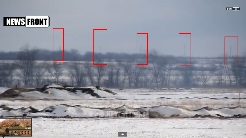
There’s also a straight row of five utility poles that can be seen on Yandex (better than on Google Earth from the firing-range field):
So it seemed like the right place, but needed to be matched better
with the video — the lines of trees and poles in the zoom shot on the
video don’t seem to work right at first when viewed on the flat map.
We asked the blogger @DaJeyPetros who runs Ukraine@War to analyze the scene in Google Earth.
He placed the camera vantage as follows on the firing range:
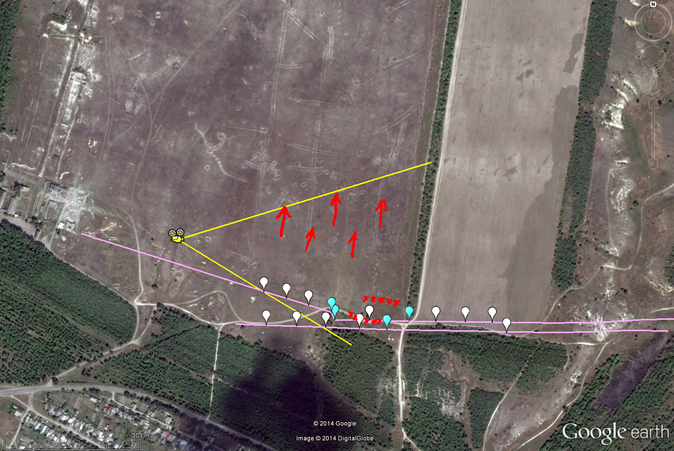
He lined up the utility poles:
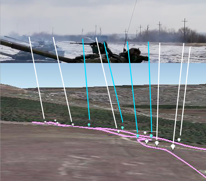
Then he matched them to the horizon in the video and the area around the BPM-97s:
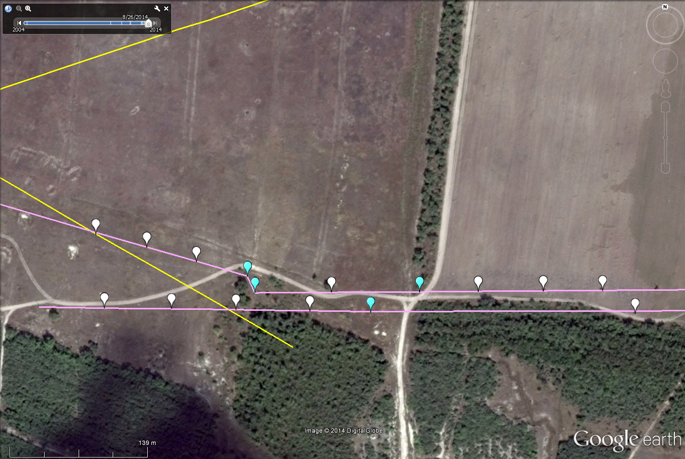
For reference, here they are in a flat view. Keep in mind that in
zooming a camera, there will be a foreshortening effect where the lines
converge:
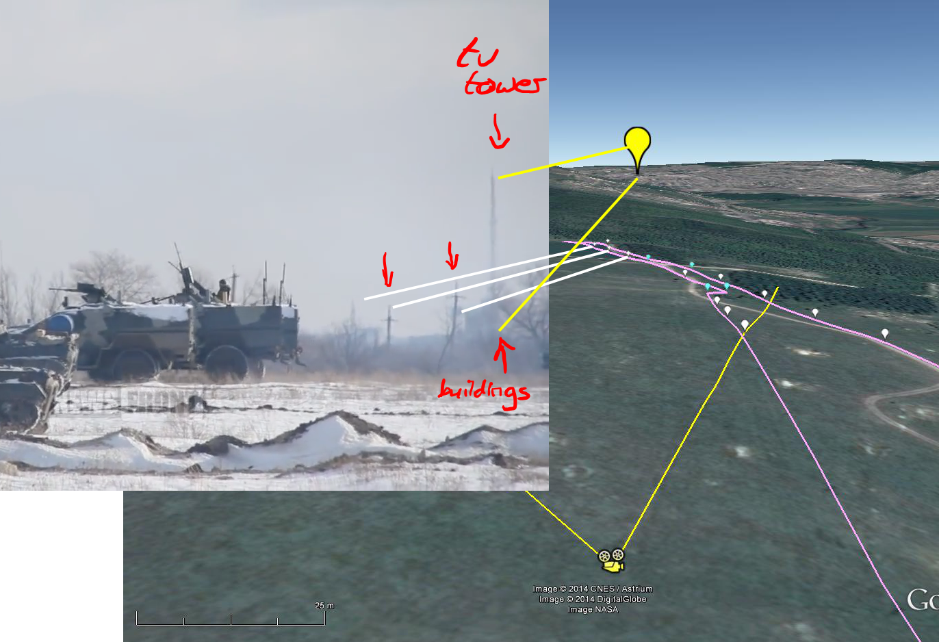
Finally, here is the TV tower position marked in yellow for reference, showing it is in the
correct position to match the video with poles to the left and right:
Now we have to explain the rest of the horizon after the utility
poles — because they are so typical of many large fields in Ukraine.
Here’s a cluster of buildings to the east and slightly north — after the rest of the utility pole positions are established, it appears they are in the view in the video and located here on Google Maps:
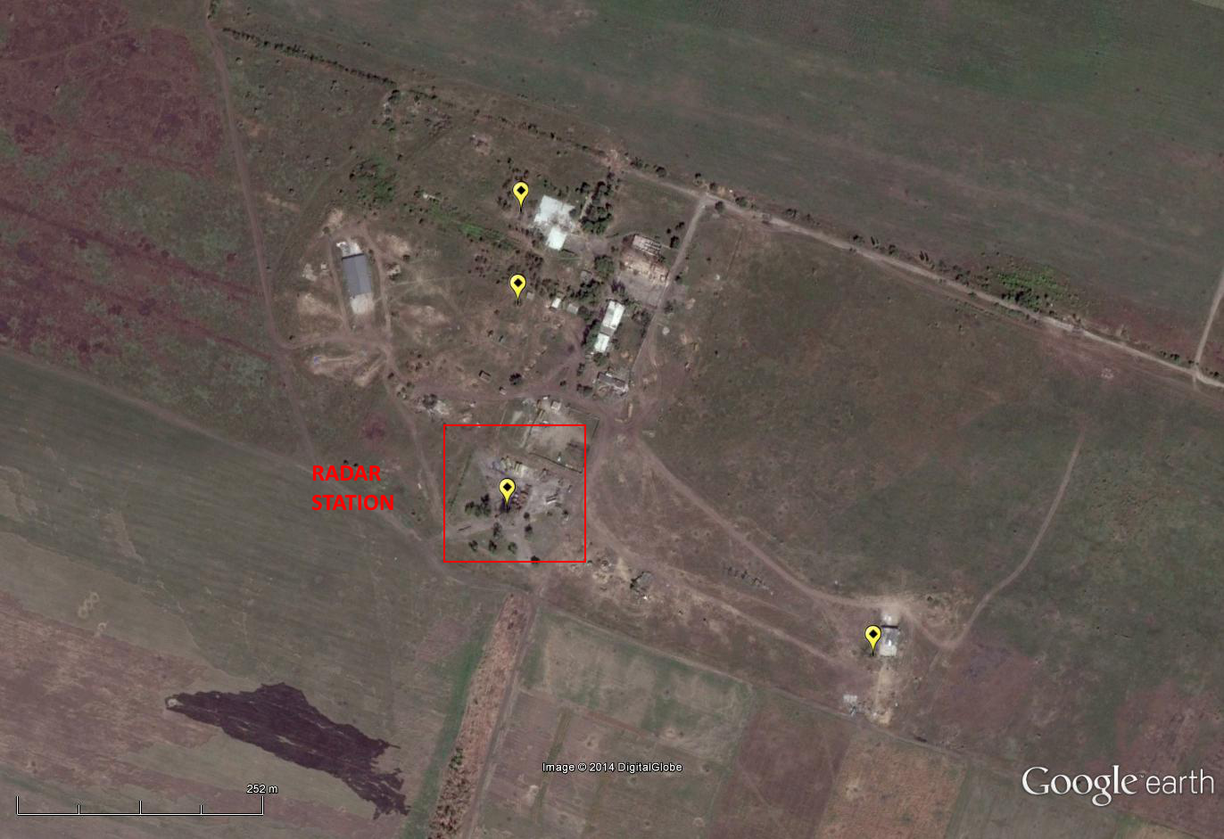
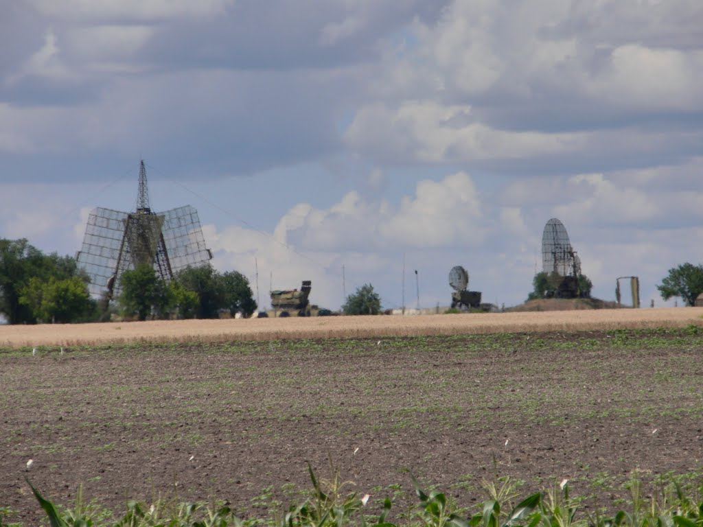
Fortunately, a photographer named gorri2 had uploaded to Panoramio a panoramic view including just that radar station within an Air Defense Command Center located here on Panoramio and here on Google Maps — and also uploaded a close-up of the radar station:
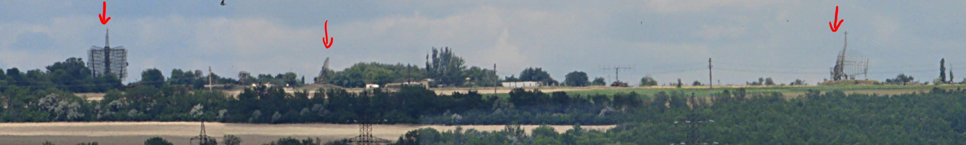
Then we could make sense of the evenly-spaced towers along the horizon visible at 4:20
in the video which match the panorama of the Air Defense Command Center:
These can all be combined then to match up the scene in the video at 4:20:
Another video was found by Lugansk News Today, uploaded the Army of the South East, two weeks earlier than the December 31 video above, on December 15, and is labeled “Combat training of mortar men on the NM LNR [People’s Militia of the Lugansk People’s Republic]
of Aleksandrovsk,” showing more training with mortars, and
demonstrating that the Russian-backed militants use this area regularly,
which looks similar to the terrain in the first video.
Putting all of these discoveries from social media together, we can
say that the Russians have delivered to the Russian-backed militants at
least 4 BPM-97s, which are not used in Ukraine and only available from
Russia, and are currently training with it during the cease-fire over
the winter holidays. The “border” vehicle is 75 kilometers from the border.
— Catherine A. Fitzpatrick